Mt. Lemmon was the next all-day adventure. (Warning, picture
heavy post) Who would have thought that outside Tucson, AZ, known for its warm
climate, was a 9,100 foot mountain and Ski Area. It sure seems out of place,
but it was a beautiful drive and a pretty day. Off we went, climbing almost
8,000 feet in about 21 miles. The road is a great two lane paved, though narrow
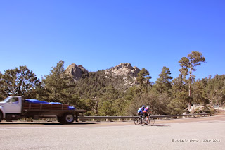
in some places, and on this day, heavily traveled by bicyclists.
 |
| Bicyclists pedal toward the top of Mt. Lemmon |
There are ample pull-outs and view points along the way. As always I took
a number of "windshield" pictures during the trip. The start of the
road, called the "Sky Island Scenic Byway"
starts out
at the general elevation of Tucson, about
2,389 feet above sea level.
As the road climbs out of Tucson proper, you see the cactus,
mostly saguaro, anchored in the desert landscape.
 |
| Saguaro Cactus along the road and hills |
Looking out over Tucson, you get an idea of
just how high you have climbed in just a few miles.
 |
| Overlooking Tucson |
I have a friend who
had a buddy that lived on the lower portion of this very road. My friend told
me of times when he and his buddy would take their wives up this road, my
friend driving a Corvette and his friend driving a Ferrari. The speed was above the posted limits
(probably well above) and it included screaming wives telling them to slow
down. As you will see this road is not
for the feint of heart.
The cactus in some areas looked like sentries standing guard in the
desert.  |
| Saguaro Cactus standing tall |
As we continued to climb up the mountain, we noticed a distinct change in the ground cover. We were not win scrub brush and Oak. At the Molino Canyon Vista we found this sign that explained the transition.
Looking around you saw little cactus, a some green scrub Oak and other species.
Then as we continued it seemed like a dramatic change to HooDoos and a little scrub greenery.
 |
| That is the road at the top of the picture |
 |
| Different colors of the rock in the cut |
 |
| Here you can see the road double back |
I know I did. Soon the HooDoos gave way to Pine trees typical of high elevation mountains.
 |
| The beautiful colors of the rock in the wall |
Up at the Ski area
we found a restaurant called the Iron Door advertising homemade pies. So, we thought that we would stop on the way down from the end of the road. At the very top, the University of Arizona has an Astronomy Center - called the "Sky Center" it however was behind a locked gate.
This area, as you can see in the pictures, was subject to a fire a couple years ago and the damage is still evident. Unfortunately for us, and about a dozen other people that stopped, the restaurant was closed. The sun shining in the window illuminated the "Open" sign, and if it had not been for the hours listed on a small sign by the gate, we would have found the door locked.
Headed back down the mountain, we discovered the little village of Summerhaven, which is also known as Mt. Lemmon. Located next to the post office a rustic looking restaurant called the Sawmill Run.
We went in and had a piece of pie and we were not disappointed. This little community has a couple of shops and is made up mostly of summer and/or winter cabins. A cute little place at the top of the mountain. The drive up the mountain had taken us something like three hours. The drive down, about 45 minutes. If you are in Tucson, this is a great little side trip, the views are outstanding. Of course, I wanted to take a different route back that would have taken us to Oracle Junction, which is north of Tucson. In checking with the locals, they stated that it was about 20 miles - known as the "Control Road" and would take about two hours. Had it not been 4PM already, that is the way we would have gone home.


No comments:
Post a Comment