If you click on a photograph, it will enlarge and should place a row of thumbnails on the bottom of your screen that you can navigate.
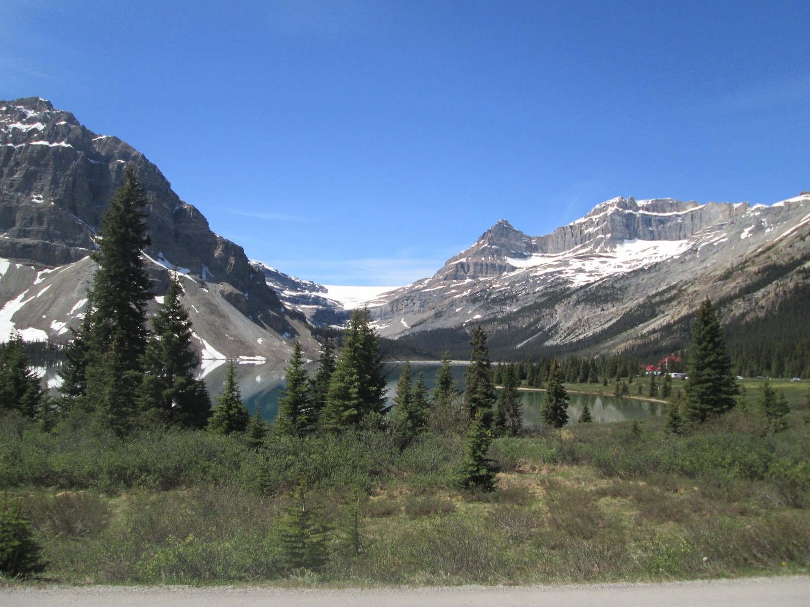
After three nights in Dawson Creek, we were ready to hit the Alaskan Highway to our next stop some 400km (248 miles) away – Fort Nelson. Highway 97 took use through farm land and the villages of Farmington and Taylor, along the Peace River. The Peace River Valley is known for all sorts of agriculture and livestock production. Fort St John, which the Alaska Highway passes through, is also mentioned many times in the history of the construction of the Alaska Highway. Most of these small villages (Fort St. John is not considered a small village) have some sort of services for the traveler, which included RV Parks. In the Village of Charlie Lake, BC there was another Rotary RV Park, on the banks of the lake. This area includes agriculture, logging and very evident the petroleum industry. We found the road to be for the most part a wide two lane road with the right-of-way on each side of the road free of brush and timber for probably 50 feet on each side. This provides excellent view of wildlife that might decide to come across or toward the road.
Winding through the foothills of the northern Canadian Rocky Mountains, it was a joy to drive, but almost to the boring side when compared to other sections of the trip so far. After passing Pink Mountain the road begins to climb and then go downhill. Slow to 35-45 MPH, then speed up to 60-65MPH.
We started to get below the ¾ tank mark on the fuel gauge and saw signs of “next services 178 Km.” So we thought we would stop for fuel at a little place called Buckinghorse River Lodge. There they had a public AFD Cardlock for fuel.

After attempting to get pre-authorization on two different credit cards – it was off to Fort Nelson without getting more fuel.
We arrived in Fort Nelson and pulled into the Triple G Hideaway RV Park. Again, without reservations, and followed in by three Motor Homes that had been in the Dawson Creek.
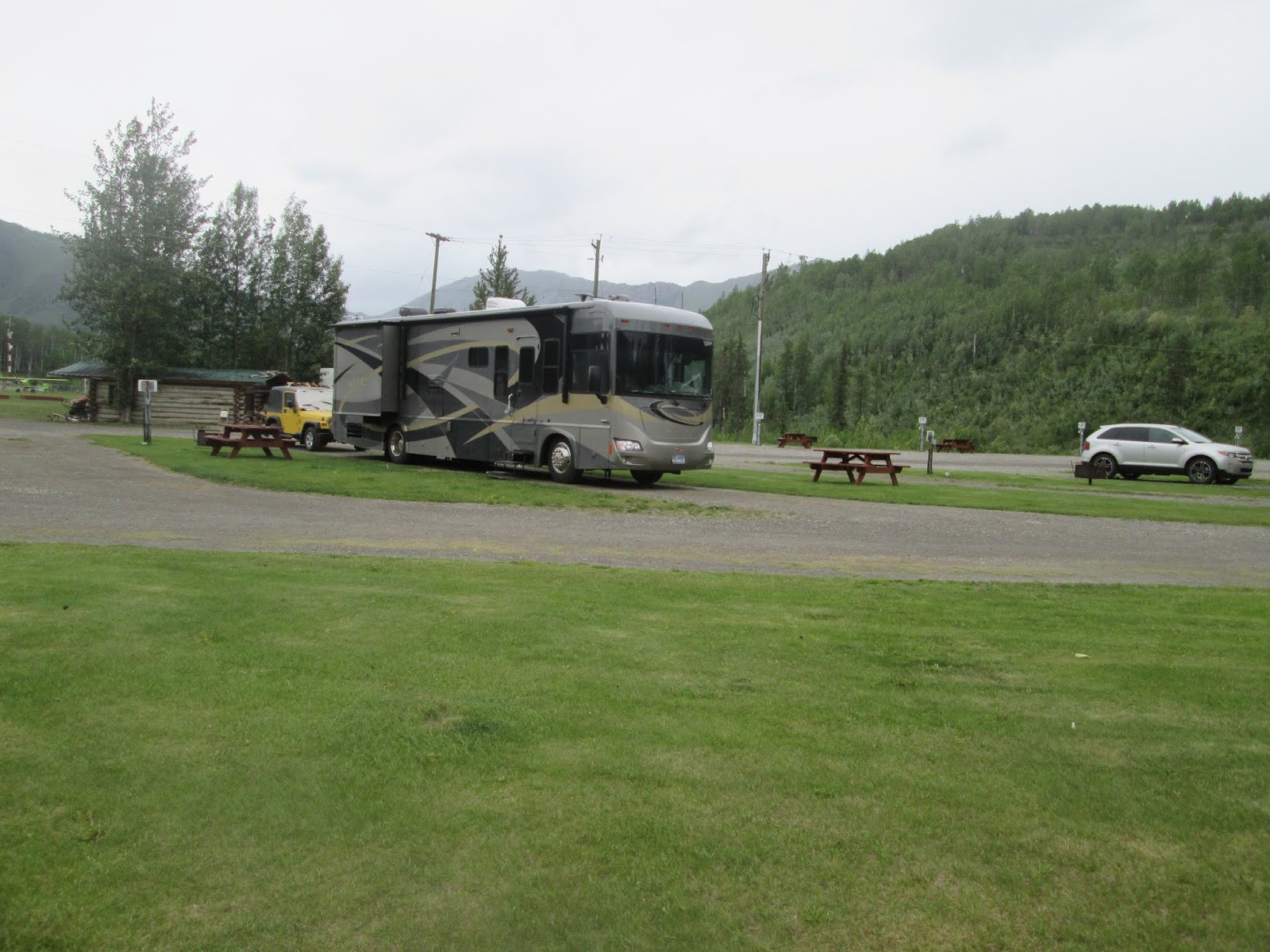
No reservation, no problem, pull through site with 30A connection, sewer and water and be careful putting the slide and awning out. This is a very tight RV Park with s few small trees between sites, ours also had a power pole.
When not used as a pull through site, they can put two short vehicles in back to back. This is again a gravel lot, we have 30A electric, water and sewer and that close up view of the neighbors RV. One couple beside us had a fifth-wheel trailer. About a ½ mile out of Fort Nelson, they had a tire blow out on the passenger side of the trailer. It destroyed the metal skirting around the dual tires, but they said that they had no damage inside and that it scared them. I can only imagine.
The RV Park also offers an RV wash pad – concrete pad, with a pressure washer. The pressure washer will do soap and rinse. Cost was a mere $1 per minute. We used it to rinse out the radiator on the motor home before we left.
We drove into Fort Nelson and located a Husky fuel station that we would have easy in and out. Then it was a stop to pick up a pizza from Boston Pizza.
Back at the RV Park, we had dinner and then I tried to get the satellite dish to get us a signal so that we could watch the Texas Rangers baseball game. In Dawson Creek I was able to get it to tune on Satellite 119W. Today, the antenna recognized Satellite 119W but the tuner just kept giving a signal loss message. Oh well – time to watch DVDs.
After three nights in Dawson Creek, we were ready to hit the Alaskan Highway to our next stop some 400km (248 miles) away – Fort Nelson. Highway 97 took use through farm land and the villages of Farmington and Taylor, along the Peace River. The Peace River Valley is known for all sorts of agriculture and livestock production. Fort St John, which the Alaska Highway passes through, is also mentioned many times in the history of the construction of the Alaska Highway. Most of these small villages (Fort St. John is not considered a small village) have some sort of services for the traveler, which included RV Parks. In the Village of Charlie Lake, BC there was another Rotary RV Park, on the banks of the lake. This area includes agriculture, logging and very evident the petroleum industry. We found the road to be for the most part a wide two lane road with the right-of-way on each side of the road free of brush and timber for probably 50 feet on each side. This provides excellent view of wildlife that might decide to come across or toward the road.
Winding through the foothills of the northern Canadian Rocky Mountains, it was a joy to drive, but almost to the boring side when compared to other sections of the trip so far. After passing Pink Mountain the road begins to climb and then go downhill. Slow to 35-45 MPH, then speed up to 60-65MPH.
We started to get below the ¾ tank mark on the fuel gauge and saw signs of “next services 178 Km.” So we thought we would stop for fuel at a little place called Buckinghorse River Lodge. There they had a public AFD Cardlock for fuel.

We arrived in Fort Nelson and pulled into the Triple G Hideaway RV Park. Again, without reservations, and followed in by three Motor Homes that had been in the Dawson Creek.
No reservation, no problem, pull through site with 30A connection, sewer and water and be careful putting the slide and awning out. This is a very tight RV Park with s few small trees between sites, ours also had a power pole.
 |
| Site with the neighbors gone |
 |
| Sites across the way |
The RV Park also offers an RV wash pad – concrete pad, with a pressure washer. The pressure washer will do soap and rinse. Cost was a mere $1 per minute. We used it to rinse out the radiator on the motor home before we left.
 |
| A couple of older vehicles on display |
 |
| Notice I called them "older" |
Back at the RV Park, we had dinner and then I tried to get the satellite dish to get us a signal so that we could watch the Texas Rangers baseball game. In Dawson Creek I was able to get it to tune on Satellite 119W. Today, the antenna recognized Satellite 119W but the tuner just kept giving a signal loss message. Oh well – time to watch DVDs.
Today, (June 18, 2019) we are on the road for a short drive of about 150 miles. Destination is the Toad River Lodge, at historic Mile Post 422 of the Alaska Highway. After getting fuel at the Husky Station, and a call to CapitalOne to find out why our card keeps being rejected, we are on the road to what turns out to be the worst part of the Alaska Highway so far. The road goes up over Steamboat Mountain and this is where the road goes to a lot of gravel patches, and some continuing for several miles.
Along the wet and rainy drive, we stopped at the Testa River Lodge located at historic Mile Post 375. This is a small store (gift shop), RV Park with a couple cabins, and is billed as the “Cinnamon Bun Center of the Galactic Cluster.” Their Cinnamon Bun was chosen as one of the top 50 Iconic Desserts in North America by Food Network.

 |
| Interior of the Testa River Lodge |


They also have Artisan meats. The Cinnamon Buns lived up to all the hype. They were fantastic. After consuming a Cinnamon Bun at the Lodge and getting a couple of them to go, and having a nice pleasant conversation with the owners, we were back on the road. We did find this interesting item right outside the entry door.
 |
| Let me think, do we know anyone that would have knowledge of one of these?...Gary |
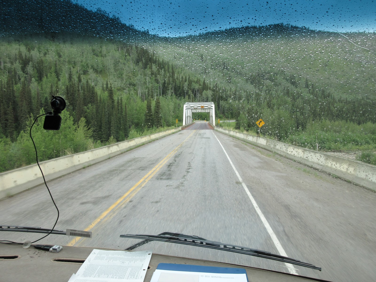 |
| One of the many bridges we crossed |
The Toad River Lodge, RV Park and Cabins, offers propane, gasoline and diesel. Inside the “lodge” they have a little restaurant, collectables and a hat collection numbering more than 10,000. The hats, most of which are signed, have been donated by customers for years. They hang from every part of the ceiling and on the walls.

For some reason while planning the trip, I decided that we would spend two nights at the Toad River Lodge. Did I mentioned that it rained and rained. We did spend two nights, as it kept us off the road for one rainy day. Limited cable television, good WiFi and walks outside when the rain diminished, along Reflection Lake filled the day off the road.
 |
| The site at Toad River |


Today, June 20, it was Toad River to Watson Lake, YT continuing on the Alaska Highway. First thing was to top off the fuel tank which we did at the Lodge, then before leaving we donated hat 11,202 to the Lodge's collection. The hat, from Billy Sims Trailer Town in Lubbock, TX is in honor of the dealership that sold us several RVs over the course of 15-16 years, and the service that they provided.

On the road, the first section was narrow, bumpy, climbing up and over a pass before dropping down and crossing the Toad River. Seems to be discrepancies as to how the river was named. One story as told in the MilePost Book, states it was because vehicles and equipment needed to be towed up the pass, so towed became toad.
After this the road improved and became a wide two-lane road with the wide right of ways - Today was good animal viewing, seeing two black bears, a brown bear, a cow elk and probably three dozen bison. The bears would run when cars came by, but the bison would lie just about on the shoulder.

Photos by Debbie Grossie


 |
| Laird River |

Arriving at the Downtown Trailer Park a little after 2PM we got settled in our pull through site on the gravel parking lot. This is the RV Park that I had heard of. A gravel lot with facilities located on it. But, this is not necessarily a destination location.


We decided to spend two nights here, with the intent of exploring the area. Most of the RVs that came in to the park were just overnighters.
We took a trip to the Sign Post Forest. Took a few pictures, perused the visitor center and found many interesting facts. As of 2018 there were 11,800 signs in the Sign Forest - Started by a US Army Engineer in 1942, he was tasked with replacing the base direction sign along the road. He did repair and refurbish the sign, but added one of his own, showing the direction and distance to his hometown. That was the start.
Over the years the City of Watson Lake took it over, provides more posts when needed. It does not appear that they will remove a sign once it is installed. Therefore some of the signs show some wear and aging.


The visitor Center also has a great display and video on the construction of the Alaska Highway. We will put our sign up tomorrow.
Dinner at Kathy's Restaurant, then a quick stop at the grocery store before going to the Northern Lights Center to see two presentations in their planetarium.

The first was on the Sun disruptions and solar storms and how they could impact power and telecommunication systems on earth. The second was on the Northern Lights - the Aurora Borealis. It was an interesting show and due to the time of year probably the only display we will see.
Day two in Watson Lake found us in the Sign Post Forest looking for an appropriate location to hang our sign.
There is no rhyme or reason in the lay out. The signs consume everything. The City of Watson Lake will put up new cedar 6x6 as needed for more signs to be placed. The signs vary in size from big to very small. They are road/street signs (should have brought a Woodrow Road Sign), lots of license plates, pieces of wood with names painted on, engraved wood signs, you name it.

Some photos are attached, which will give you the idea. I finally found a location in the center of the forest. There was a picnic table and trash receptacle close by. Our sign is made of red oak and coated with a couple layers of exterior varnish. Only time will tell how long it will last. As I write this I realized that the position of the sign will probably have it covered in snow for six months out of the year. An even better test of how the sign will hold up. Maybe somebody that reads this will drop a note if they go there and see it. The sign states our name of course, but it also has some logos paying tribute to hobbies and a former employer.


On our return trip to this area, we will probably stay here as it is close to Canada 37 which we will go south on to get to Washington State.
We then checked out Watson Lake, which is rather large. Large enough that there is a pontoon air service using the lake. We happened to find the place the plane was docked and photos are included.

 Photos by Debbie Grossie


Over the years the City of Watson Lake took it over, provides more posts when needed. It does not appear that they will remove a sign once it is installed. Therefore some of the signs show some wear and aging.


The visitor Center also has a great display and video on the construction of the Alaska Highway. We will put our sign up tomorrow.
Dinner at Kathy's Restaurant, then a quick stop at the grocery store before going to the Northern Lights Center to see two presentations in their planetarium.

Day two in Watson Lake found us in the Sign Post Forest looking for an appropriate location to hang our sign.
 |
| Entrance to the Sign Post Forest |

Some photos are attached, which will give you the idea. I finally found a location in the center of the forest. There was a picnic table and trash receptacle close by. Our sign is made of red oak and coated with a couple layers of exterior varnish. Only time will tell how long it will last. As I write this I realized that the position of the sign will probably have it covered in snow for six months out of the year. An even better test of how the sign will hold up. Maybe somebody that reads this will drop a note if they go there and see it. The sign states our name of course, but it also has some logos paying tribute to hobbies and a former employer.


After the sign placement, we checked out a fuel stop for the next day and then went west of the Alaska Highway looking for a restaurant call “Wolf it Down.” About 15 miles west we found it. It is part of a “Lodge” that has some cabins and an RV Park.

On our return trip to this area, we will probably stay here as it is close to Canada 37 which we will go south on to get to Washington State.
We then checked out Watson Lake, which is rather large. Large enough that there is a pontoon air service using the lake. We happened to find the place the plane was docked and photos are included.


Another night of limited television channel selection, no Internet and DVDs.
On June 22, after refueling at TAG (Canadian Fuel Stop) - we were on the road. Road surface for the most part was fine, except for about 25 miles of gravel. Longest stretch was probably 15-20 miles long. Light misting rain for the first half the journey.
Once past Johnson's Crossing, where we may spend a night on the return trip, the road returned to good to excellent shape.
Only two animal sightings, one porcupine and one black bear. The bear was 25 yards off the road and just walking parallel to it.
Only one stop on the way for nature and to walk the dog.
Getting into Whitehorse, I noticed that the problem with the left turn signal and park light had returned - will need to check and see if it is the bulb or the wiring. Headlights/Marker lights on all day, seems maybe to be an over-heating problem, to much amperage draw or a poor ground connection causing the problem. Will need to investigate and repair before we go much further.
Arrived in Whitehorse about 2:30p - about a 6.5 hour drive. RV Park is gravel surface. Spots are close together, but separated by brush and trees. Hookups are at the back of the site, so 25 feet of power and RG-6 (TV Cable) and 30+ feet of water line.

Some exploring of town - first stop a car wash to clean the Jeep which was covered in fine gravel and road oil/tar.

Once cleaned, we attempted to find Wal-Mart, but Garmin took us to an undeveloped area. Went to Sav-On-Foods and when leaving there we saw the Wal-Mart across the parking lot – definitely not where the Garmin said it would be.
Returned to the Motor Home and the rain started about an hour later - heavy rain.
Day two and Day three in Whitehorse will follow -
On June 22, after refueling at TAG (Canadian Fuel Stop) - we were on the road. Road surface for the most part was fine, except for about 25 miles of gravel. Longest stretch was probably 15-20 miles long. Light misting rain for the first half the journey.
Once past Johnson's Crossing, where we may spend a night on the return trip, the road returned to good to excellent shape.
Only two animal sightings, one porcupine and one black bear. The bear was 25 yards off the road and just walking parallel to it.
Only one stop on the way for nature and to walk the dog.
Getting into Whitehorse, I noticed that the problem with the left turn signal and park light had returned - will need to check and see if it is the bulb or the wiring. Headlights/Marker lights on all day, seems maybe to be an over-heating problem, to much amperage draw or a poor ground connection causing the problem. Will need to investigate and repair before we go much further.
Arrived in Whitehorse about 2:30p - about a 6.5 hour drive. RV Park is gravel surface. Spots are close together, but separated by brush and trees. Hookups are at the back of the site, so 25 feet of power and RG-6 (TV Cable) and 30+ feet of water line.


Once cleaned, we attempted to find Wal-Mart, but Garmin took us to an undeveloped area. Went to Sav-On-Foods and when leaving there we saw the Wal-Mart across the parking lot – definitely not where the Garmin said it would be.
Returned to the Motor Home and the rain started about an hour later - heavy rain.
Day two and Day three in Whitehorse will follow -